In the early morning hours of Saturday, April 5th, rising floodwaters washed out the BNSF bridge across the Spring River in northern Arkansas, near the Arkansas/Missouri state line. This route is reported to see dozens of trains daily and is considered a main rail artery.
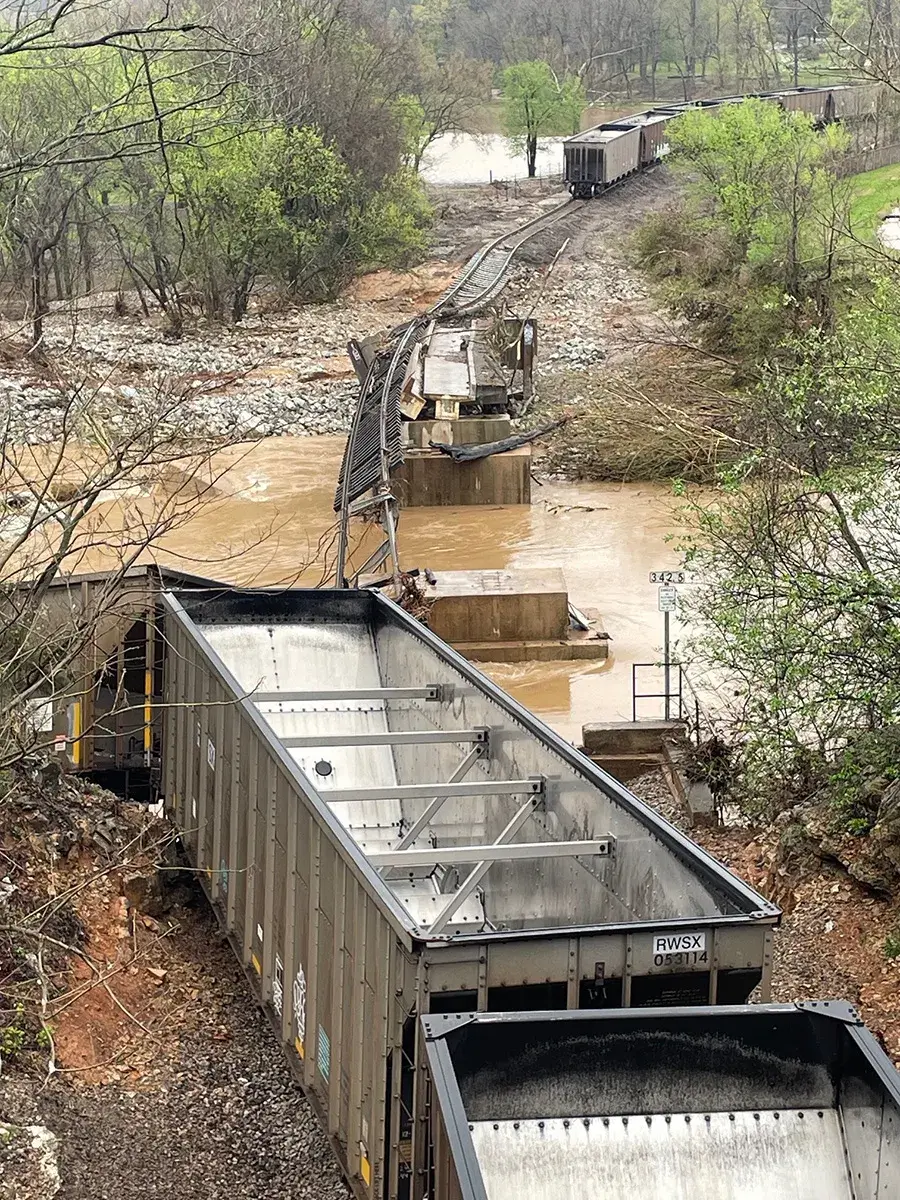
Image of destruction
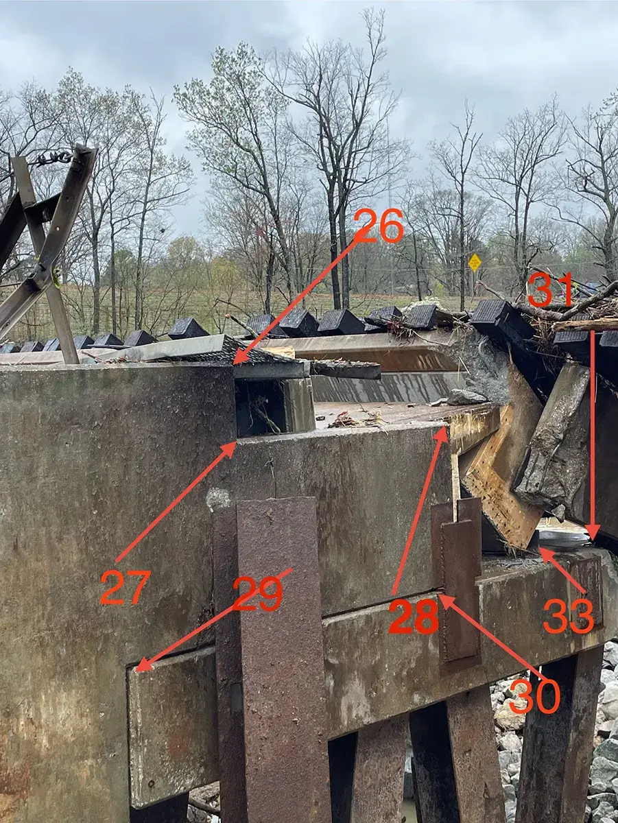
The HNTB contacted Midland Surveying on Saturday afternoon, seeking emergency assistance for land surveying services to aid in redesigning the affected portions of the bridge and track. Staff quickly mobilized and were on-site by 7:00 am Sunday. The primary request was to locate existing information on the two abutments and three piers, which included: corners of abutment barrel, corners of abutment parapet, existing anchor locations, bearing pad corners and intermediate locations, precast concrete wing walls, CL Abutment, CL Piers, and corners of pier caps. Field staff worked through adverse conditions to collect all the requested data, returning it to our CADD department by Sunday evening.
Drawing provided by Field Staff for shot locations
On Monday morning, field staff addressed the secondary request to locate the top of rail on 50’ intervals in the curves and 100’ intervals in the tangents for approximately ½ mile. All field data was collected, and crews were able to demobilize by Monday afternoon. Our CADD department provided AutoCAD drawings of the abutment and piers locations to HNTB by 11:00 am Monday and followed with top of rail centerline profiles by 5:00 pm.
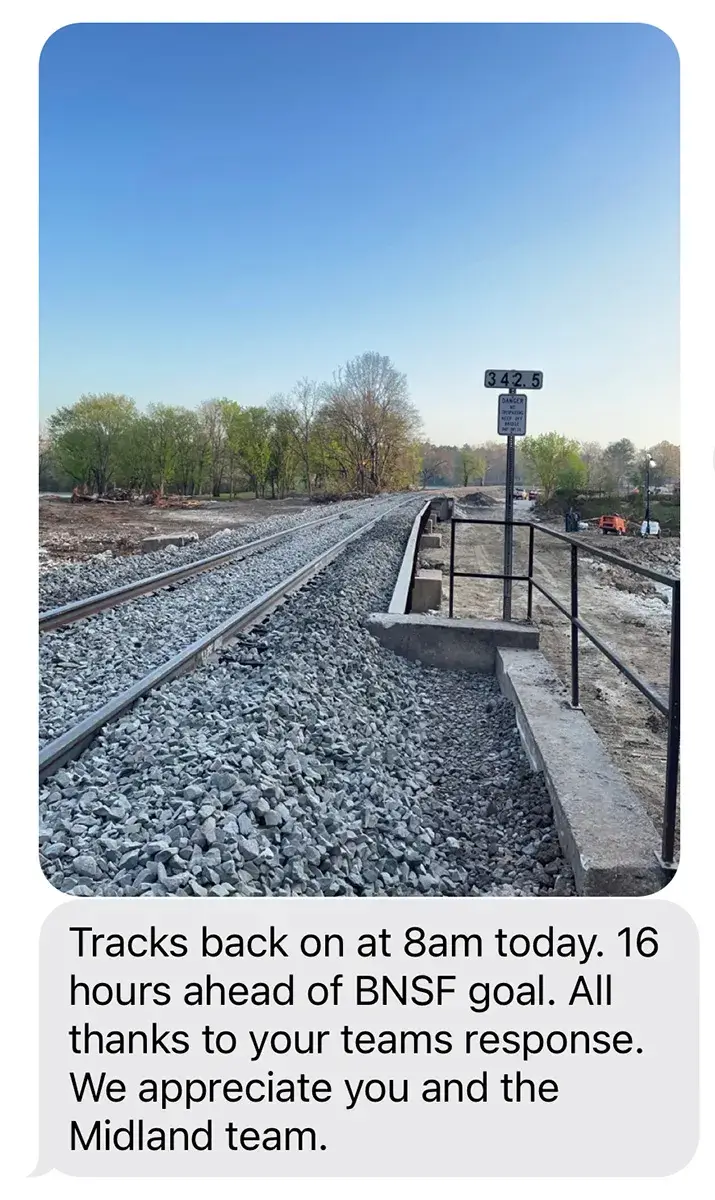
HNTB was able to use the data collected to quickly prepare a redesign, and with construction crews working around the clock, the track was reopened for rail traffic by 7:05 am on Thursday, April 10th, a full 16 hours ahead of schedule.